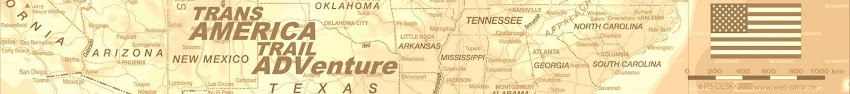


Thanks to the hard work of Sam Correro, the Trans-America Trail (TAT) project is a genuine success, due to a passionate group of TAT riders who helped Sam scout the trail, maintain its routes, and provide updates on any trail closures or bypasses. The TAT is essentially the solution to a puzzle, as all of the roads and trails in Sam's roll-charts were already in existence, but it took him nearly 12 years and tens of thousands of miles of riding to assemble the key to the route.
Please visit Sam's website for details http://www.transamtrail.com/
Maps and Roll Charts and used together for navigation. I will have a GPS unit, which is a saver in most cases when you're really lost.


Current weather along the trail